Le Brévent to Refuge de Bel Lachat
Walk 6010
Country - France
Region - Haute Savoie (74) - Chamonix Valley
Author - Lou Johnson
Length - 3.0 km / 1.9 miles
Ascent - 390 metres / 1287 feet
Descent - 20 metres / 66 feet
Time - 1.00 hours
Grade - easy/mod
Click image to visit gallery of 6 images.
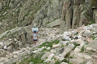
This walk takes you into some rugged country. The highlight must be the superb views across the Chamonix valley to Mont Blanc but equally impressive are the views west towards the Rochers des Fiz. The paths are well constructed with good signage. The Refuge de Bel Lachat offers an excellent place to relax and enjoy the scenery with excellent food.
Take the Télécabine from Chamonix to Planpraz and then on by cable car to Le Brévent. Alternatively take the Télécabine from Chamonix to Planpraz and then follow Walk 6010 to Le Brévent. Exit the cable car station and take time to enjoy the view. Of particular note are the retreating glaciers on the other side of the valley. Regular visitors will realise how quickly these are receding. To start the walk, take the path south. The route loses height quickly as the path descends in wide loops down the mountainside. The view ahead is good with the Aiguillette du Brévent the salient feature.
The Lac du Brévent can be seen below on your right. Shortly afterwards you reach a path junction. The TMB (Tour Mont Blanc) is straight on with a spur path leading down to the Lake. This is a worthwhile excursion although you do lose nearly 150 metres of height, which must be regained before you continue. The Lake occupies a wonderful rocky landscape. The view north is superb and makes a fitting backdrop for a picnic or rest. After visiting the lake, retrace your steps to the main path and turn right to follow the TMB once more.
You descend further to reach another junction of paths, Turn left here and descend with the TMB. A short way further you reach another junction. The TMB continues straight on but you turn left for the Refuge de Bel Lachat. This lies a few minutes along this path.
Suggested Maps
 - Carte de Randonnées "Sheet A1 - Pays due Mont-Blanc" published by Rando Editions. 1:50000 scale - Sheet A1
- Map of Mountain Footpaths in Summer - 1:40000 - Published by the Office de Tourisme
- IGN Carte de Randonnée - Samoëns - Haut Giffre - 1:25000 Sheet 3530ET
Stay Safe
Do enjoy yourself when out walking and choose a route that is within your capabilities especially with regard to navigation.
Do turn back if the weather deteriorates especially in winter or when visibility is poor.
Do wear the right clothing for the anticipated weather conditions. If the weather is likely to change for the worse make sure you have enough extra clothing in your pack.
Do tell someone where you are planning to walk especially in areas that see few other walkers.
Do take maps and other navigational aids. Do not rely on mobile devices in areas where reception is poor. Take spare batteries especially in cold weather.
Do check the weather forecast before leaving. The Met Office has a number of forecasts for walkers that identify specific weather risks.
Please Note - These walks have been published for use by site visitors on the understanding that Walking Britain is not held responsible for the safety or well being of those following the routes as described. It is worth reiterating the point that you should embark on a walk with the correct maps preferably at 1:25000 scale. This will enable any difficulties with route finding to be assessed and corrective action taken if necessary.