Desert de Platé and the Refuge de Platé
Walk 6019
Country - France
Region - Haute Savoie (74) - Chamonix Valley
Author - Lou Johnson
Ascent - 930 metres / 3069 feet
Descent - 930 metres / 3069 feet
Time - 5.00 hours
Grade - mod/hard
Click image to visit gallery of 12 images.
One of the great walks in the Chamonix Valley. This is a challenging route that requires a head for heights and sure-footedness. Under normal conditions the route can be completed by most experienced walkers. However after heavy rain there is one point in the upper reaches of the ascent and a couple lower down where crossing streams may present difficulties.
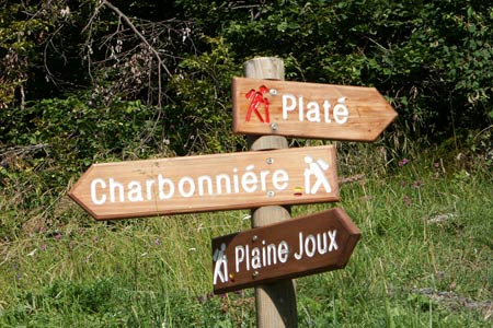
The start is from Praz Courant on the D43 from Passy to Paine Joux. Parking is available along the roadside adjacent to the hairpin bend with a crucifix and signs for the Refuge de Platé. After parking take the signed track, which climbs gently through mature woodland. After crossing the l'Ugine Torrent fork right on the signed path.
The hard work begins as the path starts to zigzag up rough ground with small shrubs dotted across the hillside. Ahead you can see the sheer limestone walls that have to be penetrated to reach the Desert de Platé. Climbing higher you gain excellent views of Mont Blanc behind you and it is worth noting that these views improve during the descent when the light is much more favourable especially for photography
Soon the shrubs become sparser and you get your first sight of the impressive vertical gully that the path uses to penetrate the rock wall. The zigzags become tighter and the climb steeper, before you round a rock face and cross an artificial ledge to reach the limestone plateau. This is another world with Limestone Pavements in abundance and the shapely summit of le Sautet to your left. Ahead, well hidden amongst the bare limestone rock, lies a group of chalets, one of which is the Refuge de Platé.
The return route is the reverse of the outward walk. Do take care in descent as there are a couple of sections of path in the upper reaches where there is some dangerous drops. Otherwise relax and enjoy the view of Mont Blanc ahead. Nearing the end of the descent remember to take time to look back. It is an impressive limestone rock wall that you have just visited.
Suggested Maps
 - Carte de Randonnées "Sheet A1 - Pays due Mont-Blanc" published by Rando Editions. 1:50000 scale - Sheet A1
- Map of Mountain Footpaths in Summer - 1:40000 - Published by the Office de Tourisme
- IGN Carte de Randonnée - Samoëns - Haut Giffre - 1:25000 Sheet 3530ET
Stay Safe
Do enjoy yourself when out walking and choose a route that is within your capabilities especially with regard to navigation.
Do turn back if the weather deteriorates especially in winter or when visibility is poor.
Do wear the right clothing for the anticipated weather conditions. If the weather is likely to change for the worse make sure you have enough extra clothing in your pack.
Do tell someone where you are planning to walk especially in areas that see few other walkers.
Do take maps and other navigational aids. Do not rely on mobile devices in areas where reception is poor. Take spare batteries especially in cold weather.
Do check the weather forecast before leaving. The Met Office has a number of forecasts for walkers that identify specific weather risks.
Please Note - These walks have been published for use by site visitors on the understanding that Walking Britain is not held responsible for the safety or well being of those following the routes as described. It is worth reiterating the point that you should embark on a walk with the correct maps preferably at 1:25000 scale. This will enable any difficulties with route finding to be assessed and corrective action taken if necessary.