Refuge de l'Alpe de Villar d'Arène from Villar d'Arène
Walk 6039
Country - France
Region - Haute Alpes (05) - La Grave & La Meije - Ecrins NP
Author - Lou Johnson
Length - 16.0 km / 10 miles
Ascent - 410 metres / 1353 feet
Descent - 410 metres / 1353 feet
Time - 5.00 hours
Grade - moderate
Click image to visit gallery of 12 images.
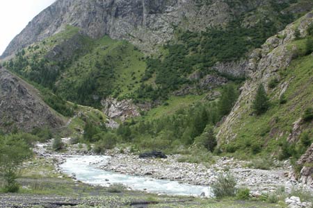
This walk follows the River Romanche upstream from the village of Villar d'Arène to a refuge that offers superb views of the surrounding mountains including La Grande Ruine.
Start & End - The village of Villar d'Arène located just off the N91 a few kilometres east of La Grave.
At Villar d'Arène parking is available in the village square by the church. From the square take the signed path by the side of the Auberge Aux Trois Frênes down to the bridge across the River Romanche. Cross the bridge and go left following the river upstream. You are now on GR54.
Reaching the trail junction for the Refuge du Pas de l'Aigle, turn left across the Pont des Brebis and turn right to continue following the river upstream. Pass the camping site of Pont d'Arsine where refreshments are usually available. Continue along a broad track to reach a parking area. GR54 continues ahead with the river entering a narrowing gorge.
The path starts to climb, crosses a small footbridge and then climbs more steeply using zigzags to gain height easily. Nearing the top the path reaches a junction. Bear left here (the return route joins here from the right). The path is signed to Refuge de l'Alpe and Col d'Arsine. After the junction the path continues to climb to reach open pastures. Continue through this wonderful valley to reach a further junction ( 2057m.). Bear right here and soon you will see the Refuge ahead.
Rather than return by the same route, leave the refuge and descend southwest into the valley to reach the main path to the Sources de la Romanche. Reaching this path continue in a south westerly direction with la Grande Ruine filling the view ahead. Soon you reach a small lake, Lac Pers, and this makes a fine place to take in the view before starting the return.
Stay on the main valley path, bearing left at the junction for the Refuge de l'Alpe. This path leads you easily back along the valley before starting an interesting descent down to reach the main trail above the zigzags. Continue along GR54 back to Villar d'Arène.
Suggested Maps
 - IGN Carte de Randonnée - Meije Pelvoux - Parc National des Ecrins - 1:25000 Sheet 3436ET
Stay Safe
Do enjoy yourself when out walking and choose a route that is within your capabilities especially with regard to navigation.
Do turn back if the weather deteriorates especially in winter or when visibility is poor.
Do wear the right clothing for the anticipated weather conditions. If the weather is likely to change for the worse make sure you have enough extra clothing in your pack.
Do tell someone where you are planning to walk especially in areas that see few other walkers.
Do take maps and other navigational aids. Do not rely on mobile devices in areas where reception is poor. Take spare batteries especially in cold weather.
Do check the weather forecast before leaving. The Met Office has a number of forecasts for walkers that identify specific weather risks.
Please Note - These walks have been published for use by site visitors on the understanding that Walking Britain is not held responsible for the safety or well being of those following the routes as described. It is worth reiterating the point that you should embark on a walk with the correct maps preferably at 1:25000 scale. This will enable any difficulties with route finding to be assessed and corrective action taken if necessary.