A walk in the Mountains of Portes du Soleil
Walk 6134
Country - France
Region - Haute Savoie (74) - Morzines, Samoëns & Abondance
Author - Donald Morton
Ascent - 420 metres / 1386 feet
Descent - 420 metres / 1386 feet
Time - 3.50 hours
Grade - moderate
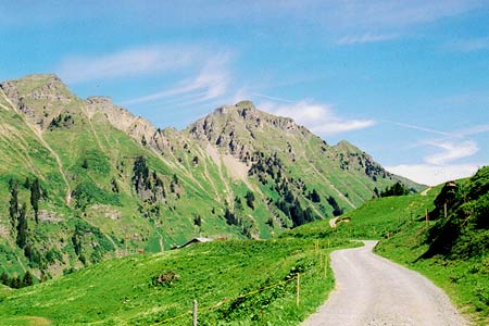
Click image to visit gallery of 7 images.
Portes du Soleil is an Alpine region on the border of France and Switzerland enfolding a dozen Swiss and French villages. This walk takes us up to the pass from which the area takes its name with changing views as one ascends culminating in a panorama of the Dents du Midi. It is described as starting at La Tovassiere, reached by driving up the Sentier Planetaire (part dirt but driveable in a normal saloon) from Morgins. This walk can be combined with walk 6130. The restaurant at La Tovassiere is open in July and August. Snow was still lying on part of the route above Lac de Chesery at the end of the first week in June, but did not create any difficulty.
Having parked at La Tovassiere (1689m) the walk unfortunately starts by going back down the approach road for a short distance following the sign to Lac de Chesery/ Col de Chesery. Look out for a narrow track forking up to the left (the sign up on the bank is somewhat concealed by bushes). Follow this up to the top of a small waterfall where a path comes in from Sassex. Here turn sharp left and continue ascending the rocky mountain path which levels off at the approach to Lac de Chesery. Turn left and pass to the right of the lake. Now the path is less steep over grassy slopes. At the next cross junction bear left (signed Cabannes de Chesery and Portes du Soleil) At the Cabannes, a mountain refuge, turn left again (signed Portes d'Hiver 20 mins, Portes du Soleil 40 mins)to pass to the left of Lac Vert and follow an ascending broad track. At the end this turns sharp left to a sign at Portes d'Hiver 2096m, the highest point of the walk with panoramic views of the Dents Blanch and Dents du Midi.
Turn left and continue down a broad track to Portes du Soleil with more views across the valley to the Dents du Midi. At Portes du Soleil, turn left again and follow the track down, ignoring one branch to the right, to come back to La Tovassiere.
Suggested Maps
 - IGN Carte de Randonnée - Morzine/Massif-du-Chablis/Les Portes du Soleil - 1:25000 Sheet 3528ET
Stay Safe
Do enjoy yourself when out walking and choose a route that is within your capabilities especially with regard to navigation.
Do turn back if the weather deteriorates especially in winter or when visibility is poor.
Do wear the right clothing for the anticipated weather conditions. If the weather is likely to change for the worse make sure you have enough extra clothing in your pack.
Do tell someone where you are planning to walk especially in areas that see few other walkers.
Do take maps and other navigational aids. Do not rely on mobile devices in areas where reception is poor. Take spare batteries especially in cold weather.
Do check the weather forecast before leaving. The Met Office has a number of forecasts for walkers that identify specific weather risks.
Please Note - These walks have been published for use by site visitors on the understanding that Walking Britain is not held responsible for the safety or well being of those following the routes as described. It is worth reiterating the point that you should embark on a walk with the correct maps preferably at 1:25000 scale. This will enable any difficulties with route finding to be assessed and corrective action taken if necessary.