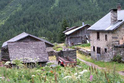
Refuge de la Pierre à Bérard from le Buet
Walk 6001
Country - France
Region - Haute Savoie (74) - Chamonix Valley
Author - Lou Johnson
Length - 16.0 km / 10 miles
Ascent - 750 metres / 2475 feet
Descent - 750 metres / 2475 feet
Time - 5.00 hours
Grade - moderate
Click image to visit gallery of 9 images.
Although this route does not visit any high level vantage point, it explores in detail a fine Alpine valley that is surrounded by mountains with the added benefit of having a mountain refuge as a destination.
The start is the village of le Buet a few kilometres south of Vallorcine on the main valley road to Chamonix-Mont-Blanc. Ample parking is available in the station car park or alternatively you could use the train.
Exit the car park and cross the main road to locate a signed path to the Cascade opposite the car park. Take this path to reach the small hamlet of la Poya where a sign explains the history of this small habitation. Stay on the path soon arriving at a bridge across the river. This lower section of the river waterfalls is quite spectacular and there is a small café where refreshments can be obtained. It is worth noting that the river is used as a channel for excess water from the Emosson reservoirs and warning signs should be heeded especially in respect of sudden changes in water levels.
Stay on the south side of the river and continue on the main valley path ignoring the next bridge across the river (Note - This bridge is where you leave the outward path on the return). Climbing steadily you reach another bridge which must be crossed and from here onwards the path stays on the north side of the river. Climbing more steeply the path eventually leaves the forest to provide a beautiful view towards the col Bérard and the surrounding mountains.
With an open valley valley prospect you should be able to see the destination with the Refuge de la Pierre à Bérard perched below the northern flanks of the Aiguilles Rouges. At one point the path splits with both routes leading to a bridge. After this final river crossing the path zigzags upwards soon levelling off to lead without any further effort to the Refuge.
The return follows the outward route as far as the bridge mentioned above. Turn left over the bridge and immediately right onto a a signed path to les Granges. This path climbs through forest to reach a path junction in a small clearing by a couple of farm buildings. Continue half left (i.e. to the left of the buildings) to follow a path down through the trees. This drops quite steeply in places to leave the forest at le Courteray. All that remains is to follow the asphalt road as it drops in a zigzag down the main valley road. Turn right along the main road to reach the start of the walk.
Things to consider - The refuge is only open mid-June until the end of September. Outside of this period snow may cover sections or all of the path. Beware of the possibility of rapid changes in water level in the river.
Suggested Maps
 - Carte de Randonnées "Sheet A1 - Pays due Mont-Blanc" published by Rando Editions. 1:50000 scale - Sheet A1
- Map of Mountain Footpaths in Summer - 1:40000 - Published by the Office de Tourisme
- IGN Carte de Randonnée - Chamonix - Massif de Mont Blanc - 1:25000 Sheet 3630OT
- IGN Carte de Randonnée - Samoëns - Haut Giffre - 1:25000 Sheet 3530ET
Stay Safe
Do enjoy yourself when out walking and choose a route that is within your capabilities especially with regard to navigation.
Do turn back if the weather deteriorates especially in winter or when visibility is poor.
Do wear the right clothing for the anticipated weather conditions. If the weather is likely to change for the worse make sure you have enough extra clothing in your pack.
Do tell someone where you are planning to walk especially in areas that see few other walkers.
Do take maps and other navigational aids. Do not rely on mobile devices in areas where reception is poor. Take spare batteries especially in cold weather.
Do check the weather forecast before leaving. The Met Office has a number of forecasts for walkers that identify specific weather risks.
Please Note - These walks have been published for use by site visitors on the understanding that Walking Britain is not held responsible for the safety or well being of those following the routes as described. It is worth reiterating the point that you should embark on a walk with the correct maps preferably at 1:25000 scale. This will enable any difficulties with route finding to be assessed and corrective action taken if necessary.