Entre les Aygues - Refuge des Bans, Ecrins
Walk 6008
Country - France
Region - Haute Alpes (05) - Vallee de la Vallouise - Ecrins NP
Author - Lou Johnson
Length - 8.0 km / 5 miles
Ascent - 500 metres / 1650 feet
Descent - 500 metres / 1650 feet
Time - 3.50 hours
Grade - moderate
Click image to visit gallery of 6 images.
This is a good walk for a half day excursion into the mountains. It is an lineear walk with an objective of visiting a refuge that is located within a dramatic cirque of mountains. The path is well trodden and navigation should present few problems unless of course visibility is low.
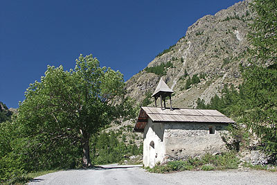
The start is fairly large car park at Entre les Aygues which is located at the western end of a minor road along the Val de l'Onde from the town of Vallouise. The drive along this valley is a pleasant experience that provides a taste of what the walk will offer.
After parking walk to the western end of the car park and locate the path heading up the valley. Do not cross the footbridge across the River Onde or follow the path rising in zigzags to your right but continue ahead on level ground through larch trees with the river on your left.
Little description is needed apart from saying that the path ahead is generally easy to follow and with well designed zigzags the height gain necessary to reach the refuge is not too strenuous. After approximately 45 minutes you will probably see the refuge perched high on a crag on the right hand side of the valley.
However there is still plenty of ascent to be completed. The path continues to follow the river and as the refuge is reached climbs more steeply as you follow a looped approach to reach the refuge from the rear.
A variety of refreshments are available and it is worthwhile spending time to enjoy the location. Rock, snow and ice prevail even in summer with Pic des Aupillous (3505m) dominating the skyline. All that remains is to retrace your steps following the outward route back to Entre des Aygues. The return is still rewarding as you are ale to enjoy magnificent mountain scenery all the way back to the car gaining a different perspective than that enjoyed on the outward leg of the walk.
Suggested Maps
 - IGN Carte de Randonnée - Meije Pelvoux - Parc National des Ecrins - 1:25000 Sheet 3436ET
Stay Safe
Do enjoy yourself when out walking and choose a route that is within your capabilities especially with regard to navigation.
Do turn back if the weather deteriorates especially in winter or when visibility is poor.
Do wear the right clothing for the anticipated weather conditions. If the weather is likely to change for the worse make sure you have enough extra clothing in your pack.
Do tell someone where you are planning to walk especially in areas that see few other walkers.
Do take maps and other navigational aids. Do not rely on mobile devices in areas where reception is poor. Take spare batteries especially in cold weather.
Do check the weather forecast before leaving. The Met Office has a number of forecasts for walkers that identify specific weather risks.
Please Note - These walks have been published for use by site visitors on the understanding that Walking Britain is not held responsible for the safety or well being of those following the routes as described. It is worth reiterating the point that you should embark on a walk with the correct maps preferably at 1:25000 scale. This will enable any difficulties with route finding to be assessed and corrective action taken if necessary.