Gasthaus Innerböden from Ginzling
Walk 6034
Country - Austria
Region - Zillertal (Tyrol)
Author - Lou Johnson
Ascent - 318 metres / 1049 feet
Descent - 318 metres / 1049 feet
Time - 2.00 hours
Grade - easy/mod
Click image to visit gallery of 6 images.
This walk starts from the village of Ginzling and climbs through the woods to the Gasthaus Innerböden. In good weather the views across the Zemm and Floifen valleys area excellent.
Start & End - Ginzling (Gasthaus Altginzling)
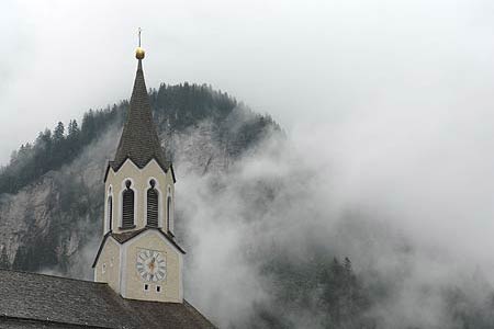
Ginzling is served by a regular bus service from Mayrhofen. From the main road, Ginzling Gasthaus Altginzling bus stop, walk down and cross the bridge over the Zemmbach River. Turn left on the other side and walk past the church with its immaculate cemetery. Just past the church turn right past the modern building housing the tourist information centre. Walk up this lane as far as the small chapel. Take the footpath to the left by the side of the chapel.
The path climbs across a meadow before entering woodland. The path climbs in zig-zags and is well signed. During the ascent you cross two wide tracks serving houses before reaching a tarmac road. Turn right on this and continue round the bend to reach the Gasthaus Innerböden.
To return to Ginzling it is easier to use the road for part of the descent. Leave the Gasthaus and descend on the road. Reaching a T-junction, go right and continue downhill. Then take the first major track on the left. This leads to a house. The signed footpath descends to the right soon reaching the meadow crossed during the first part of the walk.
Suggested Maps
 - Mayrhofen Tuxer Tal - Wanderkarte - 1:25000 - www.wave.at
Stay Safe
Do enjoy yourself when out walking and choose a route that is within your capabilities especially with regard to navigation.
Do turn back if the weather deteriorates especially in winter or when visibility is poor.
Do wear the right clothing for the anticipated weather conditions. If the weather is likely to change for the worse make sure you have enough extra clothing in your pack.
Do tell someone where you are planning to walk especially in areas that see few other walkers.
Do take maps and other navigational aids. Do not rely on mobile devices in areas where reception is poor. Take spare batteries especially in cold weather.
Do check the weather forecast before leaving. The Met Office has a number of forecasts for walkers that identify specific weather risks.
Please Note - These walks have been published for use by site visitors on the understanding that Walking Britain is not held responsible for the safety or well being of those following the routes as described. It is worth reiterating the point that you should embark on a walk with the correct maps preferably at 1:25000 scale. This will enable any difficulties with route finding to be assessed and corrective action taken if necessary.