Mont Pépoiri from Millefonts near Valdeblore
Walk 6054
Country - France
Region - Alpes-Maritimes (06) - Mercantour NP & Côte d'Azur
Author - Lou Johnson
Ascent - 700 metres / 2310 feet
Descent - 700 metres / 2310 feet
Time - 4.50 hours
Grade - mod/hard
Click image to visit gallery of 6 images.
Mont Pépoiri (2674m) is the highest summit on the grassy mountain uplands between Valdeblore and the Vesubie Valley. The route lies outside the Mercantour National Park but follows the boundary from the summit down to the Col du Barn (2452m). Superb views across the high mountain peaks that lie along the French-Italian border are a feature of this walk, which is best done between June and October although early and late season may see some lying snow that may obscure paths and make walking more difficult. There is also the danger of extensive snow cover on the summit are early in the season. The route follows good, well-marked paths for most of the way. However the approach to the summit is over grass with no clear path evident underfoot.
The start is located just over an hours drive from Nice. To reach the start you need to take an interesting mountain road from the D2565 between St-Dalmas-Valdeblore and St-Martin-Vesubie. On leaving St-Dalmas for Col St Martin, take the minor road on the left signed 'vacheries de Millefonts'. This road climbs in a series of spectacular traverses on the mountainside, and a number of hairpin bends, to reach a parking area at the end of the road at just over 2000 metres above sea level.
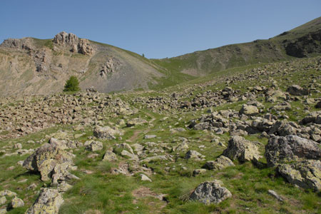
After parking walk back down the road a short way to sign no.82 (2030m) and turn left up the clear path (GR52), which rises through grassland to reach sign no.83 at the Col de Veillos (2194m). To the north east lie the steep grassy slopes of Mont Pépoiri whilst ahead is a broad valley that is the main focus of this walk.
From the Col de Veillos it is worth deciding your route over the grass to the summit. The best way is continue along a ridge on the GR52 on the path to Col de Barn and then veering off the path onto Mont Pépoiri's slopes and steadily making your way up hill. There are no technical difficulties and there is unlikely to be any snow early in the season on this south face slope.
After the exertion of the climb, arriving at the summit provides ample reward for your efforts with a superb panorama of the mountains of the Mercantour National Park, which lie in an arc to the north and east. To descend continue north (with snow likely early in the season) following a developing path over rock to Col du Barn. Turn left here at sign no.84 onto GR52.
The excellent path descends, initially with Lac Gros to your left to reach Lac Long, which is passed your right. The onwards path undulates through an interesting landscape, with red paint indicating the route where the path is not too clear. Reaching Col de Veillos again, all that remains is to make a beeline for the car park perhaps looking back at the route you have just completed.
Suggested Maps
 - IGN Carte de Randonnée - Vallée de la Vésubie Parc National du Mercantour - 1:25000 Sheet 3741OT
Stay Safe
Do enjoy yourself when out walking and choose a route that is within your capabilities especially with regard to navigation.
Do turn back if the weather deteriorates especially in winter or when visibility is poor.
Do wear the right clothing for the anticipated weather conditions. If the weather is likely to change for the worse make sure you have enough extra clothing in your pack.
Do tell someone where you are planning to walk especially in areas that see few other walkers.
Do take maps and other navigational aids. Do not rely on mobile devices in areas where reception is poor. Take spare batteries especially in cold weather.
Do check the weather forecast before leaving. The Met Office has a number of forecasts for walkers that identify specific weather risks.
Please Note - These walks have been published for use by site visitors on the understanding that Walking Britain is not held responsible for the safety or well being of those following the routes as described. It is worth reiterating the point that you should embark on a walk with the correct maps preferably at 1:25000 scale. This will enable any difficulties with route finding to be assessed and corrective action taken if necessary.