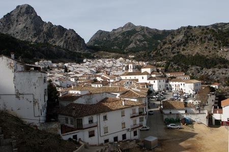
El Torreon near Grazalmena
Walk 6081
Country - Spain
Region - Cadiz Province (Andalucia)
Author - Lou Johnson
Ascent - 700 metres / 2310 feet
Descent - 700 metres / 2310 feet
Time - 3.50 hours
Grade - moderate
Click image to visit gallery of 12 images.
This walk ventures into the Sierra del Pinar range of which Torreon at 1648m is the highest peak. It is also the highest peak in Cadiz Province. This range of mountains lies to the southwest of the attractive town of Grazalmena in Cadiz Province, Andalucia. The start of the walk is the parking area close to the km 40 post on the A371 Grazalmena to El Bosque road. Note the start is nearer to Grazalmena.
Opposite the parking area the start of the walk is signed. Nowhere is the ascent steep although near the summit there are some easy scrambles to be done across the summit rocks. During the early stages of the walk the view is limited but as upward progress is made the panorama unfolds and by the summit you can see across an extensive area.
In summer the temperatures are likely to be too high for this walk. However in winter the weather is generally perfect with visibility often at its best. There is rain in winter but generally blue skies predominate.
The route is an out and back linear walk. Route finding is generally easy with some marker poles in places. From the road the path initially climbs through shrubs and small trees. After some way these give way to more open mountainside with plenty of exposed rock in the surroundings. As you get higher still the vegetation thins and at the summit rock predominates. When nearing the summit do try to remember your approach path as it can be a little confusing on the initial descent.
There are reports that permits are required to walk this route. I tried to get a permit in Grazalmena but nobody seemed to be aware of this. I started the walk early one morning in January just before sunrise and was rewarded with many sightings of Iberian Ibex and other birds and creatures. By the time I was back at the bottom there was a steady stream of walkers and I doubt whether any had permits.
Stay Safe
Do enjoy yourself when out walking and choose a route that is within your capabilities especially with regard to navigation.
Do turn back if the weather deteriorates especially in winter or when visibility is poor.
Do wear the right clothing for the anticipated weather conditions. If the weather is likely to change for the worse make sure you have enough extra clothing in your pack.
Do tell someone where you are planning to walk especially in areas that see few other walkers.
Do take maps and other navigational aids. Do not rely on mobile devices in areas where reception is poor. Take spare batteries especially in cold weather.
Do check the weather forecast before leaving. The Met Office has a number of forecasts for walkers that identify specific weather risks.
Please Note - These walks have been published for use by site visitors on the understanding that Walking Britain is not held responsible for the safety or well being of those following the routes as described. It is worth reiterating the point that you should embark on a walk with the correct maps preferably at 1:25000 scale. This will enable any difficulties with route finding to be assessed and corrective action taken if necessary.