Ronda City Stroll
Walk 6083
Country - Spain
Region - Malaga Province (Andalucia)
Author - Lou Johnson
Time - 3.00 hours
Grade - easy
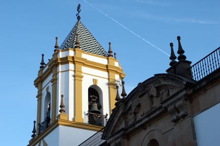
Click image to visit gallery of 12 images.
The city of Ronda is located in a mountainous area of Andalucía some 100km north of Malaga and lies at about 750m above sea level. The River Guadalevín runs through the city and has carved out a deep canyon some 100 metres deep - El Tajo canyon - which effectively divides the city in two. Most of the old city lies on what appears to be an island protected by stone walls to the south of the El Tajo canyon whilst the more modern part of the city and the Bull Ring lie to the north.
This city stroll is designed to give you some ideas of what to do and perhaps inspire you to put on your walking shoes and do some exploration. During the peak tourist season Ronda is very busy and it is an ideal place to go in winter. The research for this stroll was done on a Sunday morning in January just after day break. There was hardly a person in sight.
The main tourist information centre is outside the front of the Bull Ring and you can obtain a detailed street map from here that suggests the streets that you should explore. The map also gives brief details of what you are seeing. More detailed historical information can be obtained in the usual guide books.
The basic suggestion is to go south from the Bull Ring and cross the 'New Bridge' (Puente Nuevo) across the canyon. Despite its name it was completed in 1793! Once across the bridge you are in the old town and the best way to do this is by following an anti-clockwise route through the streets taking in at least Mondragon Palace (Palacio de Mondragon), St Mary's Church (Iglesia de Santa Maria la Mayor) and the Town Hall (Ayuntamiento). Along the way you will also be able to enjoy the lovely architecture of many of the buildings, the pleasant squares and the pleasant ambiance of this historic area. If you have time then walking to the southern end of the old city is worth the effort. This allows you to take in Church of the Holy Ghost (Iglesia del Espiritu Santo) and the principle gateway and walls to the original 13th century city.
Having completed your tour of the more historic southern part of the city, make your way to the 'Old Bridge' or 'Arab Bridge'. Cross the bridge into northern part of the city and make your way through the streets adjacent to the Canyon back to the Bull Ring (opened in 1785). This makes a fitting end to your visit to Ronda. Obviously this description is a brief sketch of what you can see and do but does provide a strategy for making the best of your visit.
Suggested Maps
 - Ronda - map showing all the sights and suggested walking routes available from the Tourist Office
Stay Safe
Do enjoy yourself when out walking and choose a route that is within your capabilities especially with regard to navigation.
Do turn back if the weather deteriorates especially in winter or when visibility is poor.
Do wear the right clothing for the anticipated weather conditions. If the weather is likely to change for the worse make sure you have enough extra clothing in your pack.
Do tell someone where you are planning to walk especially in areas that see few other walkers.
Do take maps and other navigational aids. Do not rely on mobile devices in areas where reception is poor. Take spare batteries especially in cold weather.
Do check the weather forecast before leaving. The Met Office has a number of forecasts for walkers that identify specific weather risks.
Please Note - These walks have been published for use by site visitors on the understanding that Walking Britain is not held responsible for the safety or well being of those following the routes as described. It is worth reiterating the point that you should embark on a walk with the correct maps preferably at 1:25000 scale. This will enable any difficulties with route finding to be assessed and corrective action taken if necessary.