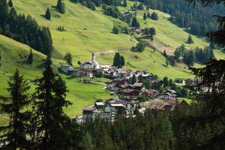
Malga Contrin from Alba/Penia
Walk 6087
Country - Italy
Region - Dolomites - Val de Fassa
Author - Lou Johnson & Dolomites Inn
Ascent - 550 metres / 1815 feet
Descent - 550 metres / 1815 feet
Time - 4.00 hours
Grade - easy/mod
Click image to visit gallery of 12 images.
This is an out and back valley walk with no navigational difficulties and can be easily completed in just over four hours with a refreshment stop en-route. The start is the cable car station which lies alongside the main road between Penia and Alba. This can be reached quite easily by bus from Canazei and there is ample parking should you arrive by car.
The route starts at the back of the main cable car carpark and consists of a well maintained track (path 602) that is also used as a service road by residents of the alps further up the valley. The start is obvious although poorly signed and signs advertising the refuges available on the walk soon provide some reassurance that you are heading the right way. Having successfully located the starting point, continue up the track climbing steeply as the route switchbacks up the steep mountainside into a hanging valley.
The first refreshments are available at Locia Contrin (1736 m) and by the time this has been reached you have already climbed 250 metres with only another 300 much easier metres to ascend. Once past Locia Contrin the valley opens up ahead of you providing some wonderful views of alpine scenery as you follow an almost flat valley floor into the mountains.
You pass path 646 signed off to the right after which you reach the recently constructed Baita Cianci refuge, which is not marked on some maps. After here the valley floor rises quite steeply again with a final sharp rise to reach the Rifugio Contrin. You may stop here but a little more effort brings some rich rewards so continue walking past the refuge and an adjacent small chapel to enter a large grassy bowl contained by mountains and crags. The path bears right and leads to the Malga Contrin. This small farm sells its fresh produce of milk, yoghurt, cream and cheeses to hungry walkers. In addition to a range of cheeses made on the farm washed down by fresh milk from their cows, you can also tackle some of the wonderful cakes filled with ricotta and fruit!
This farm is mountain eating at its best and offers wonderful fresh ingredients at excellent prices. A visit to the toilet is also an interesting experience as it is located in the cow shed which was occupied by some calves and pigs on my visit.
It is a hard place to leave with the fine food complemented by a stunning mountain location. All that is required now is to retrace your steps back down the valley perhaps tempted by the offerings of the other refuges passed on the way to the bottom.
Suggested Maps
 - Val di Fassa e Dolomiti Fassane - 1:25000 scale - sheet 06 published by Tabacco
Stay Safe
Do enjoy yourself when out walking and choose a route that is within your capabilities especially with regard to navigation.
Do turn back if the weather deteriorates especially in winter or when visibility is poor.
Do wear the right clothing for the anticipated weather conditions. If the weather is likely to change for the worse make sure you have enough extra clothing in your pack.
Do tell someone where you are planning to walk especially in areas that see few other walkers.
Do take maps and other navigational aids. Do not rely on mobile devices in areas where reception is poor. Take spare batteries especially in cold weather.
Do check the weather forecast before leaving. The Met Office has a number of forecasts for walkers that identify specific weather risks.
Please Note - These walks have been published for use by site visitors on the understanding that Walking Britain is not held responsible for the safety or well being of those following the routes as described. It is worth reiterating the point that you should embark on a walk with the correct maps preferably at 1:25000 scale. This will enable any difficulties with route finding to be assessed and corrective action taken if necessary.