Rifugio Sasso Plato and the Val Duron from Campitello
Walk 6088
Country - Italy
Region - Dolomites - Val de Fassa
Author - Lou Johnson
Ascent - 200 metres / 660 feet
Descent - 900 metres / 2970 feet
Time - 4.00 hours
Grade - moderate
Click image to visit gallery of 12 images.
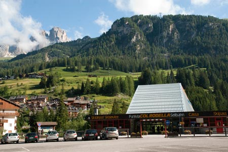
This balcony walk takes you across the southern flanks of the Sassopiato and Sassolungo limestone massifs with their towering crags and spires. The route offers superb views across the Val Duron to the spectacularly wild limestone area containing Antermoa. The start is in the attractive village of Campitello which lies on the main Val di Fassa road. Locate the Rodela cablecar valley station (1448 m.) where ample parking is available. (Note there are a variety of special fares available on the cablecars for those needing more than one ride.)
Take the cablecar up to Rodela (2387 m.) from where there is an excellent view to the Sassopiato and Sassolungo which lie just to the north of the cablecar station. Follow path 529 to Forc Rodela (2318 m.) and then fork left onto path 557 to Rifugio Friedrich August (2298 m.), which is instantly recognisable from the with large bull outside. Continue on path 557 to Rifugio Sandro Pertini (2300 m.) along the flanks of Sasso Piatto. The views to your left are very good on this section.
Continue on path 557 to the Rifugio Sasso Piatto (2300 m.). Despite the similar altitudes there are some ups and downs so do not expect completely flat walking! Like all balcony paths you get plenty of views for relatively little effort and this path is no exception. There are a couple of sections where you might have to use your hands and there are two places where cables provide extra security.
Turning sharp left you descend to the small farm named Malga del Sasso Platto (2243 m.) which provides yet another temptation to have some food or drink! From the farm initially follow the path alongside a stream which should be on your right. This is path 533 which leads you downhill with relative ease to the Rifugio Malga Micheluzzi (1860 m.) where more refreshments await. The return to Campitello is completed by following the road, which offers a straightforward and pleasant descent back to the start despite some sections being steeply graded.
In season there is a shared taxi service operating down the valley from Rifugio Malga Micheluzzi. Times and fares are displayed on a notice board adjacent to the Rifugio.
See walk 6089 for a longer version of this route
Suggested Maps
 - Val di Fassa e Dolomiti Fassane - 1:25000 scale - sheet 06 published by Tabacco
Stay Safe
Do enjoy yourself when out walking and choose a route that is within your capabilities especially with regard to navigation.
Do turn back if the weather deteriorates especially in winter or when visibility is poor.
Do wear the right clothing for the anticipated weather conditions. If the weather is likely to change for the worse make sure you have enough extra clothing in your pack.
Do tell someone where you are planning to walk especially in areas that see few other walkers.
Do take maps and other navigational aids. Do not rely on mobile devices in areas where reception is poor. Take spare batteries especially in cold weather.
Do check the weather forecast before leaving. The Met Office has a number of forecasts for walkers that identify specific weather risks.
Please Note - These walks have been published for use by site visitors on the understanding that Walking Britain is not held responsible for the safety or well being of those following the routes as described. It is worth reiterating the point that you should embark on a walk with the correct maps preferably at 1:25000 scale. This will enable any difficulties with route finding to be assessed and corrective action taken if necessary.