Isola Palmaria from Portovenere
Walk 6097
Country - Italy
Region - Ligurian Coast (including Cinque Terre)
Author - Lou Johnson
Time - 3.00 hours
Grade - easy/mod
Click image to visit gallery of 9 images.
The island of Palmaria (Isola Palmaria) offers an excellent half day walk amongst its rugged landscape. The island was home to a military camp which is now out of use. Its most famous aspect is the excellent marble that was once quarried but this too has ceased operation as extraction became uneconomical.
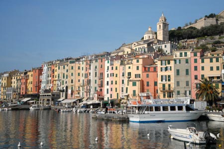
There is a regular ferry service to the island during the summer. The service is more limited off-peak and may not run in the winter. Details of the ferry service can be obtained on the quayside at Portovenere where tickets can be purchased at a booth on the quay.
The journey across to the island takes about 10 minutes during which time you have the opportunity to get your bearings. The ferry drops passengers at two places ? Punta Secca which is the nearest point across the channel and Terrizzo which can be described as the main centre of habitation on the island.
Whichever place you disembark, turn left (with the sea on your left) along the main coastal track cum footpath. Terrizzo is recognised in that it has a restaurant with rooms. If you alight at Terrizzo you do not pass the restaurant but can see it from the landing stage. Assuming you have disembarked at Terrizzo you will soon pass an information board which offers some guidance on flora and fauna.
The track splits, keep right, and follow the sign for Pozzale. The onward route is easy to follow and quite soon you reach a villa. Here take the right hand path that leads uphill and is signed Pozzale. The rocky path climbs to reach a viewpoint over the isle of Tino before reaching another junction where you walk left signed Pozzale. The path contours across the hillside offering good views.
Another junction is reached where you turn left to Pozzale. The path descends steeply with ropes for assistance. At the bottom you reach a group of buildings and the beach at Pozzale. There is a café here in season. Pass behind the buildings and follow the seafront. Ahead you can see some of the extensive marble quarries.
You reach another junction where you turn right uphill to Vetta and Carlo Alberto. The path climbs steeply under trees to reach a grand viewpoint where you can see the high cliffs of the western side of the island. You can see the ongoing route which leads uphill to the communication tower on the summit of the island (186 metres above sea level). During the climb you will pass a right hand path to Terrizzo. Ignore this and continue uphill to the summit.
Here you have two choices. The easiest is to follow the lane which zigzags downhill. There are short cuts signed and these lead you down to the shore to where you first arrived. The other option is to take the signed track from the summit to Carlo Alberto. Just past the Batteria Semaforo descend a stepped path towards Carlo Alberto to reach a wide path at its bottom.
After just over 200 metres continue down a narrow, steep path on loose terrain. There are ropes for assistance in places. The trail eventually reaches the bottom at the north-western point of the island with the church of San Pietro on rocky prominence across the channel.
All that remains is to follow the seafront path back to either Punta Secco or Terrizzo for the ferry back to Portovenere.
Suggested Maps
 - Kompass - Sheet 644 - Cinque Terre - scale 1:50000
Stay Safe
Do enjoy yourself when out walking and choose a route that is within your capabilities especially with regard to navigation.
Do turn back if the weather deteriorates especially in winter or when visibility is poor.
Do wear the right clothing for the anticipated weather conditions. If the weather is likely to change for the worse make sure you have enough extra clothing in your pack.
Do tell someone where you are planning to walk especially in areas that see few other walkers.
Do take maps and other navigational aids. Do not rely on mobile devices in areas where reception is poor. Take spare batteries especially in cold weather.
Do check the weather forecast before leaving. The Met Office has a number of forecasts for walkers that identify specific weather risks.
Please Note - These walks have been published for use by site visitors on the understanding that Walking Britain is not held responsible for the safety or well being of those following the routes as described. It is worth reiterating the point that you should embark on a walk with the correct maps preferably at 1:25000 scale. This will enable any difficulties with route finding to be assessed and corrective action taken if necessary.