Vigla, Kirkis Mountains, Samos
Walk 6101
Country - Greece
Author - Barry Mackie
Length - 21.0 km / 13.1 miles
Ascent - 1445 metres / 4769 feet
Descent - 1445 metres / 4769 feet
Time - 9.00 hours
Grade - hard
Click image to visit gallery of 3 images.
The Island of Samos is much loved by walkers and amongst the many popular trails, this one is well worth a look. Due to the time it takes to complete, few people attempt the whole route, so you will find that after an hour or so you've pretty much got the mountain to yourself. This summit is the highest point of the Aegean peninsular and if you complete this walk you will literally have ascended every metre.
From the bus stop opposite the Hotel Votsalakia at the edge of the town of Kambos take the road out of town alongside the beach, heading west. Cross a bridge over a small river, and turn right onto an asphalted road, signposted (in Greek) to Evangelistria.
After a few minutes, turn left at the T-junction and follow what has now become a rough track, which winds its way through the olive groves. Approx 1 hour later turn right at the major fork in the track (also indicated by red painted arrow on rocks). After another approximately 100m, there is a blue capped shrine to the left of the track. Retrace your footsteps 10m and there is a narrow gap through the shrubbery, also on your left. Pick your way carefully up the rocky path following the way markers that are still red paint on the rocks or plastic discs on the trees.
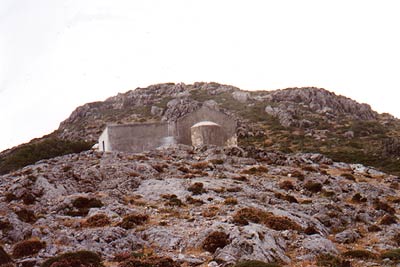
The grounds of the Moni Evangelistria (the monastery) are reached after 45 minutes and the monastery itself after another 15 minutes. Here will be your last chance to refill your water bottles.
Take the path to the right of the monastery through the trees, still following the way markers, which whilst still predominantly red, are now occasionally blue. As you leave the tree line behind you the path becomes rocky and you will need to take extra care on the steep scree covered slope. The next landmark is the Chapel Profitisilias reached in approximately 1hour after leaving the monastery.
From here the summit is in sight but there is still some way to go. Pass the chapel taking the feint path on the right hand side and keep bearing to the right to avoid the deep valley in front of you. Now detour round the false summit until you reach the left flank of Vigla and then make your way up its rocky slope until you reach the main summit 50 minutes after leaving the chapel. From here, 1443 metres above sea level, there are fabulous views of the Fourni Islands, Ikaria and several parts of the Turkish mainland.
To return to Kambos, take the same route back down the mountain.
Things to consider - Equipment and clothing, as per any walk of this duration, with additional emphasis on sun protection. There are snakes and scorpions on Samos, so watch where you place your hands and feet, and also where you put your rucksack. Due to the high summer temperatures, an early start is essential.
Stay Safe
Do enjoy yourself when out walking and choose a route that is within your capabilities especially with regard to navigation.
Do turn back if the weather deteriorates especially in winter or when visibility is poor.
Do wear the right clothing for the anticipated weather conditions. If the weather is likely to change for the worse make sure you have enough extra clothing in your pack.
Do tell someone where you are planning to walk especially in areas that see few other walkers.
Do take maps and other navigational aids. Do not rely on mobile devices in areas where reception is poor. Take spare batteries especially in cold weather.
Do check the weather forecast before leaving. The Met Office has a number of forecasts for walkers that identify specific weather risks.
Please Note - These walks have been published for use by site visitors on the understanding that Walking Britain is not held responsible for the safety or well being of those following the routes as described. It is worth reiterating the point that you should embark on a walk with the correct maps preferably at 1:25000 scale. This will enable any difficulties with route finding to be assessed and corrective action taken if necessary.