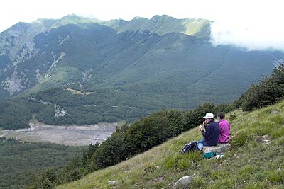
Lago Acuto from near P.So Langastrello
Walk 6114
Country - Italy
Region - Northern Tuscany
Author - Piccolo Mulino
Length - 7.5 km / 4.7 miles
Ascent - 560 metres / 1848 feet
Grade - moderate
Click image to visit gallery of 4 images.
This is a mountain walk and you need to prepare accordingly. The recommended map is Parco Del Gigante, Sheet 14 / 16 (1:250000) and the walk should not be attempted unless you have this map. In addition do not attempt in bad weather or low cloud and do tell someone your plans before leaving the valley base. Good way marks most of the way, red and white Club Alpino Italiano with path numbers (sometimes) do help with navigation. No refreshments are available on this route.
The walk combines woodland trails, a mountain lake and a ridge traverse with spectacular views. You may see and hear wild boar, you will certainly see where they have been digging up the ground looking for food. This is a beautiful walk and well worth the effort. On a clear day you will be able to see the coast and the Ligure Sea.
Directions to the start - Exit the A15 Autostrada ( Palma to La Spezia) at the Aulla exit approximately 15Km from La Spezia. From Aulla follow the SS665 signposted P.So Langastrello and pass through the villages of Monti, Licciana Nardi, and Tavernelle. On reaching the pass continue on, passing L.Paduli on you right hand side, at the end of the lake turn right over the bridge. Immediately after the bridge park on the left hand side of the road on a wide hard shoulder.
The walk - The walk starts at the end of the bridge near the footpath sign, follow direction Rif Sarzana trail 659, after a few meters you come to a stone obelisk make sure you are still following the same trail and direction. Leaving the lake behind climb steadily taking time to look back at the spectacular views of Mont Malpasso and the villages of Rigoso and Aneta below in the Enza river valley on your left. Continue on this path ignoring others until you reach the Rufugio De Sarzanna (3Km). This is a pleasant clearing in the forest with a brilliant green lake (L. Acuto) a few meters away.
On leaving the Refugio go round the left hand end of the lake and follow the trail 657 going right along the back of the lake. The path climbs steadily up to the ridge (4Km). On reaching the ridge you join the trail AV2000 however at this point it is only marked with the red & white marks, continue straight ahead in the direction of L.Paduli , as the track starts to descend it splits with the AV2000 going to your left (5Km). The track you follow goes to the right in the direction of L.Paduli (at this time it does not have a number) continue down this zigzag track until you join the 659A (6Km) take the right hand track following at a distance the lake shore back to the start.
Suggested Maps
 - Parco Del Gigante, Sheet 14 / 16 (1:250000)
Stay Safe
Do enjoy yourself when out walking and choose a route that is within your capabilities especially with regard to navigation.
Do turn back if the weather deteriorates especially in winter or when visibility is poor.
Do wear the right clothing for the anticipated weather conditions. If the weather is likely to change for the worse make sure you have enough extra clothing in your pack.
Do tell someone where you are planning to walk especially in areas that see few other walkers.
Do take maps and other navigational aids. Do not rely on mobile devices in areas where reception is poor. Take spare batteries especially in cold weather.
Do check the weather forecast before leaving. The Met Office has a number of forecasts for walkers that identify specific weather risks.
Please Note - These walks have been published for use by site visitors on the understanding that Walking Britain is not held responsible for the safety or well being of those following the routes as described. It is worth reiterating the point that you should embark on a walk with the correct maps preferably at 1:25000 scale. This will enable any difficulties with route finding to be assessed and corrective action taken if necessary.