Circular Walk in the Annapurna Foothills
Walk 6125
Country - Nepal
Author - Paul Webb
Grade - no grade
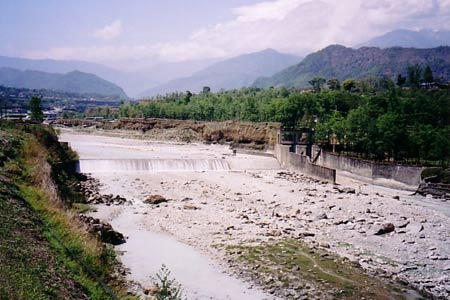
Click image to visit gallery of 23 images.
The outline route includes Pokhara, Ghandrung, Ghorepani, Poon Hill, Birithanti and Sarankot. Duration is 7 days during which the maximum altitude reached is 3,210m (10,530ft). Total ascent during the trek is approximately 4,200m (13,000ft).
This is a fairly strenuous walk but taken in short steps with plenty of time to enjoy the views, the country and the village life of the charming people of Nepal. Our visit, in April 2006, gave us more than we bargained for as, due to the political situation at the time, there was very limited (or no) local transport available - we had some extra trekking to do on the roads around Pokhara. We could not have made the trip at all when we did without the excellent assistance of our guide and porters and although travelling conditions are now more stable in Nepal, we would recommend making use of well organised, decently paid local guides - it is one of few sources of income in the region and costs next to nothing by western standards. Similarly, we used a UK company for all our arrangements - Himalayan Kingdoms (now Mountain Kingdoms) (Mountain Kingdoms ) - whose services were excellent during a difficult time in Nepal's history.
Accommodation: There is a plentiful supply of "tea house" lodge accommodation which is very cheap if you also eat there. You could not walk for more than 2 hours without passing somewhere to stay (and eat/drink) if you needed to stop. You would need your own sleeping bag.
Pokhara is a charming and interesting provincial town reached by air or bus from Kathmandu, and makes an excellent base for exploration of the Annapurna Region. You need a permit to walk in the hills - available on the trail so do take spare passport photos.
Day 1 Pokhara - Phedi - Dhampus (+600m)
The plan was to load up our gear, meet our guide and porters and get a minibus up to the start of the trail at Phedi (17Km NW of Pokhara). A combination of strikes and curfew meant we could start instead with 17km of road work on a hot day. North through the outskirts of town from the airport as people built fresh barricades to thwart the authorities later in the day and then west along the valley of the Seti River (behind Sarangkot) (Photo 612501) for a quiet lunch of Momos (buffalo ravioli) below the monastery at Hyangja. The road remains mercifully flat through rice fields (Photo 612502) towards the "start" at Phedi. Turning right off the road the trail climbs immediately steeply through forest, before opening up to pass through terraced farmed areas and glimpses into the dwellings and lives of the farming hill people (Photo 612503). Having climbed approx 500m (2-3hrs from Phedi) you reach the first night stop at the village of Dhampus where you will be greeted by the children's traditional call of "sweets!" Try to get a room with a view to the North because if you arrive later in the day the view may well be obscured by mist � but in the morning get up early for what may be your first and most memorable view of the Holy Mountain - Macchapuchare - the fishtail.
Day 2 Dhamphus - Deurali - Tolka - Landrung (+ 330m , -330m)
Enjoy a good breakfast - trekkers' honey will ease "mountain throat". Hopefully, you will have savoured an early view of Macchapuchare although there is a lot more of that to come. The trail heads NW gently towards Pothana through the rhododendron woods (Photo 612504) towards the top of the ridge at Deurali. Here there are splendid views all round with a possibility of a first sight of Dhaulagiri to the NW.
Head N steeply down through the woods through Bheri Kharka and round Tolka as the views open up into the mighty valley of the Modi Khola river (Photo 612505) which runs down from Machhapuchare Base Camp (MBC). You contour gently round to the Gurung village of Landrung for your overnight stop.
Day 3 Landrung - Ghandruk ( -200m , + 600m )
Ghandruk is Landrung's sister village and looks temptingly and deceptively close across the valley. Take the path N from the village and then immediately plunge left down to the river and try not to realise that for every step down you will be taking two upwards on the other side! (Photo 612506) The river supports a variety of birdlife and is crossed by a substantial bridge leading to one of the famous endless "Gurung staircases". Take your time climbing and stop frequently to admire the views, watch the children playing or chasing their animals, (Photos 612507 and 612508) or drink a black tea from a wayside teashop. Before you know it you'll be in the substantial slate-roofed village of Ghandruk round about lunchtime. Depending on the time of year, the more energetic may be tempted to go further, but the morning view from Ghandruk justifies a lazy afternoon! From here you get the best view of Macchapuchare (Photo 612509) to the NE and Annapurna South and Hinchuli to the N.
Day 4 Ghandruk - Deorali - Tadopani (+700m)
Up and west from Ghandruk (Photo 612510) through the fields and into the forest for a day mostly climbing through rhododendron (18m high!) and magnolia (Photo 612511). You may start to feel the air thinner and cooler at 2000m though nowhere on this trek should you be troubled with altitude sickness (nevertheless take precautions). You may see monkeys in the woods approaching Tadopani which will be reached 4/5 hours walking time from the start. Tadopani nestles into the wooded mountainside still with the spectacular views (Photos 612512 and 612513) of Macchapuchare and Annapurna South which you feel you could reach out and touch! The village is a lively crossroads and you can swop stories with those crossing from Chomrong and Annapurna Base Camp (ABC) as well as invest in craftwork from Nepal and Tibet in the street stalls. There are several tea house lodges to choose from. (Photo 612514)
Day 5 Tadopani - Banthanti - Deurali - Ghorepani ( - 250m, + 500m)
Now walking at over 2,500m, almost each step will open up another superb view or angle on one of the peaks in the Annapurna range. Be careful to take the Banthanti track W not the northerly one towards Chomrong when leaving the village. Down through the forest (Photo 612515) to a small stream and the steeply up to Banthanti for a well earned tea. More uphill through the forest to reach another junction at Deurali (approx 4 hrs from start) and press on W to one of the best sections of the whole trek as the ridge opens up the views of the western Annapurnas (Photos 612516 and 612517), Dhaulagiri and the Kali Gandaki Valley. At the top of the ridge you can buy a drink from a small shack and look across to Poon Hill - tomorrow's summit (Photo 612518).
Day 6 Poon Hill - Banthanti - Ulleri - Hille - Birethanti (+ 400m, -1800m)
Tradition dictates that you rise very early and get up to Poon Hill to see the sunrise. (45min.) You had best ask locally about the weather and the time of sunrise, but either way you'll hear people on the move in good time. At the top, you will hopefully be rewarded with the view of the trek: almost the whole Annapurna range (Photo 612520) in gently changing light as the sun rises over the fishtail which now looks distant in the eastern edge, and lights Dhaulagiri in the west (Photo 612519), square and impassable, snow blowing from the summit. Don't rush back for breakfast - it will be a while before you see another sight so beautiful.
From Ghorepani take the old trading Tibetan trading route S including some very steep downhill sections (Photo 612522) through Banthanti, Ulleri, Hille and eventually to Birethanti sitting in the Modi Khola valley. On the way down you will have seen many more people than elsewhere on the trek and hopefully some interesting wildlife, domestic animals and flora to take the mind off the sore knees. Birithanti (Photo 612523) will offer a broader cuisine than the mountain lodges but the daal bhaat (lentils & rice) fuel will still serve you well here. There is plenty of retail opportunity here. If you have a guide and porters, it's a good evening to buy them a beer and give them their tips.
Day 7 Birethanti to Pokhara (+ 300m, - 1000m)
Now the smart thing to do from here is walk down to the bus stop at Naya Pul and get the bus back to Pokhara and have a beer and buffalo steak. If the country is in the middle of a coup you can walk the 35Km back to Pokhara via Lumla and then along the Sarankot ridge before dropping down the last 600m towards the inviting Phewa Tal lakeside. If you do the walk it takes about 11 hours and you'll never forget it.
Suggested Maps
 - 1:125,000 trekking map by Shangli-La : Around Annapurna
Stay Safe
Do enjoy yourself when out walking and choose a route that is within your capabilities especially with regard to navigation.
Do turn back if the weather deteriorates especially in winter or when visibility is poor.
Do wear the right clothing for the anticipated weather conditions. If the weather is likely to change for the worse make sure you have enough extra clothing in your pack.
Do tell someone where you are planning to walk especially in areas that see few other walkers.
Do take maps and other navigational aids. Do not rely on mobile devices in areas where reception is poor. Take spare batteries especially in cold weather.
Do check the weather forecast before leaving. The Met Office has a number of forecasts for walkers that identify specific weather risks.
Please Note - These walks have been published for use by site visitors on the understanding that Walking Britain is not held responsible for the safety or well being of those following the routes as described. It is worth reiterating the point that you should embark on a walk with the correct maps preferably at 1:25000 scale. This will enable any difficulties with route finding to be assessed and corrective action taken if necessary.