Levanto to Monterosso by the coast path
Walk 6143
Country - Italy
Region - Ligurian Coast (including Cinque Terre)
Author - Lou Johnson
Length - 9.0 km / 5.6 miles
Ascent - 300 metres / 990 feet
Time - 4.00 hours
Grade - easy/mod
Click image to visit gallery of 6 images.
This linear coastal walk provides a useful introduction to walking in this area and takes you across the Punta Mesco peninsula with views of the rocky coast and the Mediterranean. The path is generally easy to follow and the climb out of Levanto is not too hard. However the final descent into Monterosso is quite steep although never difficult and care is needed for this section. Linear walks are easily achieved using the frequent train service along the coast. For example after completing this walk you can easily return to Levanto by train where a ten minute walk soon has you back in the centre.
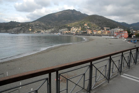
This walk starts from the seafront in Levanto. Walk south along the promenade (with the sea to your right) and continue past a large villa to take a stepped path uphill to 'Salita San Giorgio'. Reaching the top of this initial ascent you reach a lane. Turn right and almost immediately you reach a junction, where you continue straight ahead on a lane to Monterosso. The path is way marked with red and white flashes. The path becomes stepped again for a short way.
Continue climbing, passing a guest house and some ruined houses, and a short way after a junction. Continue straight ahead to reach a road. Turn right and continue to reach a bar. Just after turn right onto a signed path to Punta Mesco. The character of the path changes and you begin to enjoy open views high above the shoreline. Reaching a junction by some houses, bear right to Monterosso.
The path makes its way through woodland before the landscape opens out and coastal views can again be enjoyed. Reaching the highest point of the path, views along the Cinque Terre coast open out ahead. Reaching a junction with the path to Monterosso coming in on your left, bear right and continue a short way to Punta Mesco. The path ends at the ruins of the Sant Antonio Hermitage.
After enjoying the views return to the junction and start the descent to Monterosso. As you lose height you will get a good view of Monterosso. Reaching a road, bear left and after a short way take the signed footpath on the right. This descends to another road which you follow downhill. After 300 metres take the path on your right which leads down to the seafront in Monterosso.
You can continue along the promenade (passing the railway station on your left) to reach a tunnel. You can go through the tunnel but it is better to bear right and follow the path towards the next bay and the old town.
It is worth noting that there are few opportunities for refreshments until you reach Monterosso so it is important to take enough water with you.
Suggested Maps
 - Kompass - Sheet 644 - Cinque Terre - scale 1:50000
Stay Safe
Do enjoy yourself when out walking and choose a route that is within your capabilities especially with regard to navigation.
Do turn back if the weather deteriorates especially in winter or when visibility is poor.
Do wear the right clothing for the anticipated weather conditions. If the weather is likely to change for the worse make sure you have enough extra clothing in your pack.
Do tell someone where you are planning to walk especially in areas that see few other walkers.
Do take maps and other navigational aids. Do not rely on mobile devices in areas where reception is poor. Take spare batteries especially in cold weather.
Do check the weather forecast before leaving. The Met Office has a number of forecasts for walkers that identify specific weather risks.
Please Note - These walks have been published for use by site visitors on the understanding that Walking Britain is not held responsible for the safety or well being of those following the routes as described. It is worth reiterating the point that you should embark on a walk with the correct maps preferably at 1:25000 scale. This will enable any difficulties with route finding to be assessed and corrective action taken if necessary.