Deia to Soller
Walk 6153
Country - Spain
Region - Mallorca
Author - Andy Chaplin
Length - 12.3 km / 7.7 miles
Ascent - 460 metres / 1518 feet
Descent - 619 metres / 2043 feet
Grade - easy/mod
Click image to visit gallery of 2 images.
This is another relatively easy walk following the well-signed paths from Deia to Soller. There are several alternative routes that can be taken but this walk predominantly follows the GR221, the Cami de Castello and the Cami de Rocafort. The walk is not circular but both ends are on the bus route from Palma through Deia to Soller so it is easy to get back to either Deia or Palma. The bus stops in the centre of Deia and on the outskirts of Soller.
In Deia it is worth having a look around the village before going north on the Ma-10 out of the village. A short way along the road the GR221 heads off to the left down the valley towards Cala de Deia but it is possible to continue along the road, on a good footpath, to the next bus stop. This means that you pass the Robert Graves museum and get the views from the road down the valley to Cala de Deia.
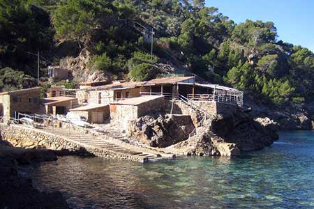
At the bus stop take the road that winds down the valley side towards Cala de Deia. When you pick up the GR221 again the path starts to cut off some of the loops of the road. There is a short section following the road again before the GR221 branches off uphill on the right. It is worth the extra mile to go down to the bay at Cala de Deia, have a stroll on the coast, then come back up to the GR221.
The path climbs back up the valley and then turns eastwards as it starts to follow a route parallel to the coastline. After half a mile you join the track from the house at Son Bujosa and then come back onto the main road. After a short section with no footpath you turn off on the right, initially on a path then onto the Carrer ses Coves C'an Puigserver. The GR221 is then signed off on the left and continues as the Cami de Castello all the way to Capella de Castello.
There are great views down the hillside to the coast and the path crosses the Torrent de sa Casa Nova where some of the path seems to have been recently repaired. The walking is fairly easy going, directions are easy to follow but the rock paths require some concentration and sometimes, as the path seems to be on the olive grove terracing, there are terrace-wall rock-falls to walk around.
At Capella de Castello carry on the Cami de Casello towards s'Heretat then, when the Cami de Rost branches off to the left, keep straight on past Cas Porc. Just short of 6 miles into the walk leave the track and take the path signed off to the left towards Soller and follow it down to C'an Gamundi. After another 1 km turn off left on the Cami de Rocafort which descends down the hill towards Soller.
The path is steep and rocky and can be difficult if wet. It crosses the tramway twice as the tram loops around to drop down into Soller. The path comes out on the Ma-11 opposite the petrol station and the centre of town is straight on across the road and the bus stop is left then first right on Carrer de Cetre.
Suggested Maps
 - Walking Paradise Soller (1:15000) and guide book published by Editorial Alpina
Stay Safe
Do enjoy yourself when out walking and choose a route that is within your capabilities especially with regard to navigation.
Do turn back if the weather deteriorates especially in winter or when visibility is poor.
Do wear the right clothing for the anticipated weather conditions. If the weather is likely to change for the worse make sure you have enough extra clothing in your pack.
Do tell someone where you are planning to walk especially in areas that see few other walkers.
Do take maps and other navigational aids. Do not rely on mobile devices in areas where reception is poor. Take spare batteries especially in cold weather.
Do check the weather forecast before leaving. The Met Office has a number of forecasts for walkers that identify specific weather risks.
Please Note - These walks have been published for use by site visitors on the understanding that Walking Britain is not held responsible for the safety or well being of those following the routes as described. It is worth reiterating the point that you should embark on a walk with the correct maps preferably at 1:25000 scale. This will enable any difficulties with route finding to be assessed and corrective action taken if necessary.