Fornalutx circular
Walk 6156
Country - Spain
Region - Mallorca
Author - Lou Johnson
Length - 2.3 km / 1.4 miles
Ascent - 120 metres / 396 feet
Descent - 120 metres / 396 feet
Grade - easy
Click image to visit gallery of 3 images.
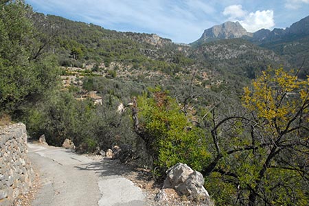
This short and, at times, energetic walk takes you above the village of Fornalutx passing through the terraced olive groves with wide ranging views of the surrounding mountains including Puis Major, the highest peak on the island of Mallorca.
From the main square, Plaça Espanya in the centre of the village climb the steps to the left of the church. Keep climbing up Carrer Tramuntana until you pass the last house on your right. Where the path divides, bear left onto a signed path to Cami de s?Alzina Fumadora. The cobbled stepped path leads upwards to reach a tarmac road (Ma-2120).
Turn left and follow this road to just before a road junction with the Ma-10, Soller to Luc road, On the left about 100 metres before the junction is a footpath sign back to Fornalutx. Take this track which passes between terraced olive groves with views to the mountains on the other side of the valley and across the rooftops of Fornalutx. As the track winds its way downhill there are some walkers? shortcuts.
As you descend you pass a house on the left (La Bisbala) and shortly after, where the lane bends to the left (marked by a lamp-post), bear right down a steep stepped path. This leads down into the village, where you turn left to return to the main square.
Suggested Maps
 - Walking Paradise Soller (1:15000) and guide book published by Editorial Alpina
Stay Safe
Do enjoy yourself when out walking and choose a route that is within your capabilities especially with regard to navigation.
Do turn back if the weather deteriorates especially in winter or when visibility is poor.
Do wear the right clothing for the anticipated weather conditions. If the weather is likely to change for the worse make sure you have enough extra clothing in your pack.
Do tell someone where you are planning to walk especially in areas that see few other walkers.
Do take maps and other navigational aids. Do not rely on mobile devices in areas where reception is poor. Take spare batteries especially in cold weather.
Do check the weather forecast before leaving. The Met Office has a number of forecasts for walkers that identify specific weather risks.
Please Note - These walks have been published for use by site visitors on the understanding that Walking Britain is not held responsible for the safety or well being of those following the routes as described. It is worth reiterating the point that you should embark on a walk with the correct maps preferably at 1:25000 scale. This will enable any difficulties with route finding to be assessed and corrective action taken if necessary.